Things to Do in Kerry: A Complete Guide
From Killarney's lakes to the Ring of Kerry and the Skellig Islands — how to plan your time in Ireland's most scenic county.
A separate peninsula from the Ring of Kerry, with its own driving loop, its own Gaeltacht Irish-speaking villages, and a 1,300-year-old stone oratory most visitors have never heard of.
 By Ireland Spots Team
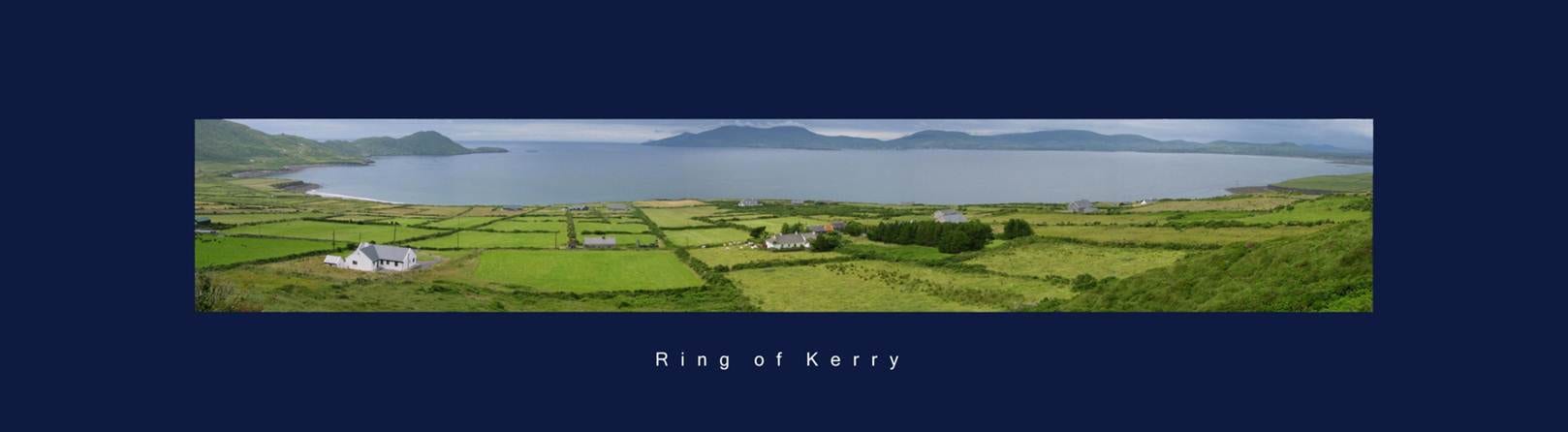
Photo: Ventus55 / Wikimedia Commons (CC BY-SA 4.0)
The Dingle Peninsula gets mentioned in passing on most Kerry itineraries and then skipped in favour of the Ring of Kerry — which is a shame, since it's a genuinely separate day out with its own driving loop, its own town, and an Irish-speaking area the Ring doesn't have.
The natural base for the peninsula, a working fishing town with a harbour, pubs and restaurants that feel built for locals first rather than purely for visitors. It's the start and end point for the Slea Head Drive, and roughly an hour's drive from Killarney if you're basing yourself there for the rest of a Kerry trip.
A signposted loop — broadly the R559 — starting and ending in Dingle town, taking in Slea Head itself (with views out toward the Blasket Islands), Dunquin Pier, and a scattering of historic sites along the way including Kilmalkedar Church and Dún Beag promontory fort. It runs about two hours end to end with minimal stops; budget a half-day if you want to actually get out of the car at each one.
A small, dry-stone early Christian church on the western end of the peninsula near Ballyferriter, built entirely from locally sourced stone in a shape that resembles an upturned boat — no mortar holding it together, just carefully corbelled stonework that's kept it weatherproof for well over a thousand years. It's reachable via a free public path or through a small visitor centre with a car park and a short audio-visual introduction; check current access and any visitor-centre fee before you go.
The western end of the Dingle Peninsula, including the village of Ballyferriter, is part of the Corca Dhuibhne Gaeltacht — one of Ireland's officially recognised Irish-speaking regions. Road signs and place names switch to Irish-only through this stretch, which genuinely surprises visitors expecting English throughout; it's one of the more tangible reminders in Kerry that Irish is a living, spoken language here, not just a historical curiosity.
No — they're separate peninsulas, both in County Kerry but each its own day out. The Ring of Kerry circles the Iveragh Peninsula; Dingle is further north, with its own town and its own driving loop, the Slea Head Drive.
A signposted loop, roughly the R559, starting and ending in Dingle town — about two hours end to end with minimal stops, longer with any. It takes in Slea Head itself, with views toward the Blasket Islands, along with Dunquin Pier and several historic sites along the way.
The western end of the peninsula is part of the Corca Dhuibhne Gaeltacht, one of Ireland's officially recognised Irish-speaking regions — road signs and place names in this stretch are in Irish, which catches some visitors by surprise.
Practical details last verified 5 November 2026.
From Killarney's lakes to the Ring of Kerry and the Skellig Islands — how to plan your time in Ireland's most scenic county.
The full driving route around the Iveragh Peninsula — the towns along the way, which direction to actually drive it in, and why that direction matters.
Kerry's base town — how to get there, what's in the town itself, and the national park sights right on its doorstep.